- First we prepared a questionnaire with the help of the sample they sent us from
Institute for forests (IFF). We distributed it among the Solkan and Nova Gorica students.
- Students filled in the questionnaire with the help of their parents.
- We analysed the questionnaire.
- The information from the questionnaire was put in a chart that shows what areas are more
or less visited.
- We walked or cycle through the roads we didnít know.
- With the help of topographical map in the measure 1:25000, from 1997, we drew roads and
painted the areas of recreation in the map sent us by IFF. We used the colours that were
given in the IFF instructions.
- We used the names of places from topographical map from 1996 (1:25000) to describe the
directions of the roads and the places they connect.
- We sent our research work to the OFF and we achieved their certificate.
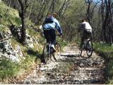
- We would like to change some roads that are now only for walking also to the cycling
areas, thatís why we cycled all that roads and photographed them. From the photos you
can see
  they are already quite suitable for
cycling. In our opinion not big work is needed to change those roads into cycling paths
but only a bit of cleaning, cutting of bushes and marking the paths from time to time
would be enough. they are already quite suitable for
cycling. In our opinion not big work is needed to change those roads into cycling paths
but only a bit of cleaning, cutting of bushes and marking the paths from time to time
would be enough.
|